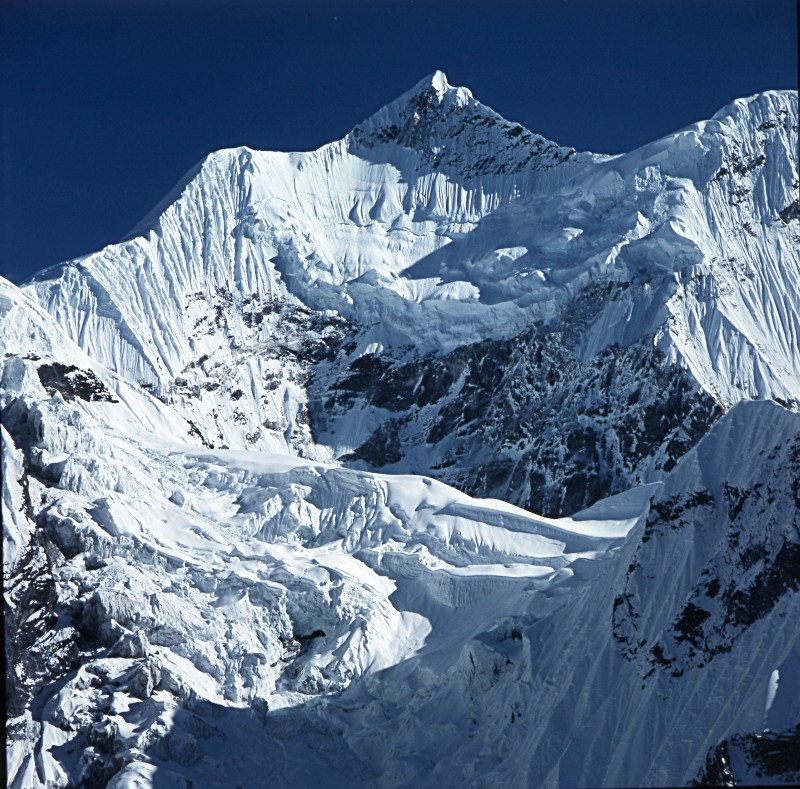
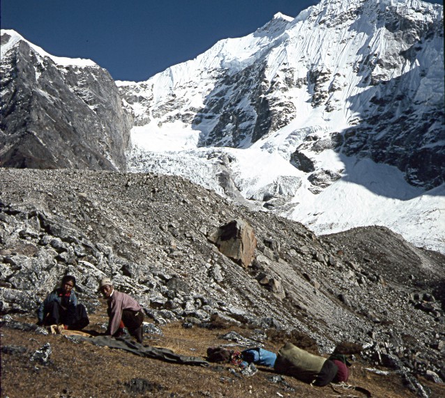
© Dr. Klaus Dierks 2004: Photo: Panayo Tippa 6 696 m on the Border between Rolwaling and Khumbu: On the Trek from Rolwaling to Everest Base Camp
PHOTO DOCUMENTATION: ROLWALING'80: THE MOST DIFFICULT ACCESS TO THE MOUNT EVEREST BASE CAMP VIA THE TRASHI LAPTSA IN NEPAL
Klaus Dierks
© Dr. Klaus Dierks 2004-2005
© Dr. Klaus Dierks 2004: Photo: Panayo Tippa 6 696 m on the
Border between Rolwaling and Khumbu: On the Trek from Rolwaling to Everest Base Camp

Copyright of Map: Research Scheme Nepal Himalaya (Schneider Maps)

Copyright of Map: Nelles Verlag
From August to December 1980 we (Gerd Kuchling from Windhoek and myself) undertook the "First Namibia Trekking Expedition" to the Base Camp of Chomolungma/Mount Everest 8 850 m, the highest peak on earth. We used not the normal access trail to the Base Camp via Jiri and Junbesi to Namche Bazar and Tengpoche, but the most difficult access through the remote and seldom visited Rolwaling Himal with Gaurisankar 7 146 m as highest peak. The Rolwaling Valley between the 7 000 m high peaks in the north at the Tibet/Chinese Border, and the numerous more than 6 000 m high peaks in the south is a cul-de-sac. The crossing of the Drolambao and Trakarding glaciers, the Drolambao Icefall and the nearly 6 000 m high Trashi Laptsa represents an extremely difficult crossing into the Khumbu and the Everest Base Camp and can be regarded as one of the most difficult mountain traverses in the world (Sir Edmund Hillary). At the present-day the Rolwaling is a closed area and can only be visited with a Nepalese Expedition Permit which is difficult to obtain and extremely expensive. In 1980 things were easier and we obtained without any problem a Trekking Permit for the Rolwaling, without knowing which adventure we would eventually face. Our Sherpa Guide, Nima Lama, promised to be an experienced mountain guide, but it was later found out that the had practically no mountaineering experience at all. After we had negotiated our way to the Drolambao Icefall, we discovered that Nima Lama had forgotten our ice screws in Kathmandu. We were not able to cross the icefall and had to return to Beding, the main village of the Rolwaling. In Beding a French Himalaya Expedition rescued us, and we were now able, with their assistance to return and cross the icefall and Trashi Laptsa, and make our way to the Everest Base Camp in the Khumbu.
![]()
LAPCHI KANG: FROM KATHMANDU VIA BAHRABISE TO THE FIRST HIGH PASS ON THIS TREK: TINSANG LA 3 319 m

Copyright of Map: Research Scheme Nepal Himalaya (Schneider Maps): Lapchi
Kang: 1 : 50 000
We left Kathmandu at a frosty autumn morning in late September 1980. We travelled with our Sherpa guide, the cook and eight porters via Bhaktapur, the Dhulikel Pass into the Sun (Bhte) Kosi Valley to Bahrabise at the Sun Kosi 1 200 m, the point of exit of our trek. From there we climbed from 1 200 m via the Hindu temple Ohreni and Dolangsa 2 490 m up to to our first pass, the Tinsang La 3 319 m, which lies embedded in the sub-tropical mountain forests of the Lapchi Kang.

East of Kathmandu, Nepal's Capital: Thimi with the Langtang Himal in the Background: View
to the North
Copyright of Photo: Dr. Klaus Dierks

Dolalghat in the Sun River Valley: Our Porters checking our
Expedition Luggage for the next Months to come: View to the Northeast
Copyright of Photo: Dr. Klaus Dierks

At Bahrabise 1 200 in the hot and steamy Sun River Valley: Point
of Exit of our Trekking Expedition'80 to the Rolwaling and the Khumbu: Gerd Kuchling to
the left
Copyright of Photo: Dr. Klaus Dierks

Bahrabise 1 200 m at the Sun River Valley: Point of Exit of our
"First Namibia Trekking Expedition'80" to the Rolwaling and the Khumbu: View to
the North in Direction Kodari and the Tibetan Border
Copyright of Photo: Dr. Klaus Dierks

From Bahrabise we climb from 1200 m to 1 700 at Okhreni:
The first arduous hundred Altitude Metres seem to be more than "the Climb of Mount
Everest": Our Porters in Front of me carry their 25 kg Loads on their Backs: View to
the East in Direction Ohreni
Copyright of Photo: Dr. Klaus Dierks

One of many "Chautaras" on the "Bato" (Foot
Path) to Okhreni, a Rest Place for the Nepalese Porters to rest with their heavy Back
Loads: View to the North into the Bhote Kosi in Direction Tibet
Copyright of Photo: Dr. Klaus Dierks

The Sunwar Village Okhreni (The Sunwar are one of many Nepalese
Peoples: They live between the Newar in the West in the Valley of Kathmandu and the Sherpa
in East Nepal (In Tibetan Language: East People: They immigrated in the 15th Century from
Tibet to East Nepal): View to the South into the Sun Kosi Valley
Copyright of Photo: Dr. Klaus Dierks

The Hindu Temple in Okhreni: Our first Night Stop on our Trek
Copyright of Photo: Dr. Klaus Dierks

The Sunwar Village Karthali: View into the Sun Kosi Valley in
the South
Copyright of Photo: Dr. Klaus Dierks

A Sunwar House at Karthali: In the Background the Sun Kosi
Valley
Copyright of Photo: Dr. Klaus Dierks


The Sunwar Village of Dolangsa 2 500 m is the last Village
beforeTinsang La 3 319 m and our second Nightstop before approaching Tinsang La
Copyright of Photos: Dr. Klaus Dierks

The Tinsang La 3 319 m with its Sub-Tropical Mountains Forests
forms the Boundary between the mainly Hinduistic Sunwar People and the Buddhist People of
the Sherpas in the eastern Parts of Nepal
Copyright of Photos: Dr. Klaus Dierks
![]()
LAPCHI KANG: FROM THE TINSANG LA 3 319 m TO THE SHERPA VILLAGE OF CHILANGKA AND LADUK

Copyright of Map: Research Scheme Nepal Himalaya (Schneider Maps): Lapchi
Kang: 1 : 50 000
View to the Sherpa Village of Ruphtang: View into the Tamba Kosi Valley in the East
Copyright of Photo: Dr. Klaus Dierks

Our Porters on our Way to Ruphtang: View to the East
Copyright of Photo: Dr. Klaus Dierks

The first Tschörtens (Buddhist Reliquaries) show that we have
entered the Buddhist Sherpaland: View to the East into the Tamba Kosi Valley
Copyright of Photo: Dr. Klaus Dierks

From Ruphtang: View to the East into the Tamba Kosi Valley
Copyright of Photo: Dr. Klaus Dierks


Buddhist Tschörtens between Ruphtang and Bigu Gompa:
Tschörtens are still built to the Present-Day by the devoted Sherpa (right Photo)
Copyright of Photos Dr. Klaus Dierks

Bigu Gompa 2 650 m: Our third Nightstop
Copyright of Photo: Dr. Klaus Dierks

Our Descent from Bigu Gompa to Chilangka 1 900 m: In the Front
our Guide Nima Lama and in the Back Gerd Kuchling
Copyright of Photo: Dr. Klaus Dierks

Chilangka: In the Background the 5 000 Metre high Peaks of the
Lapchi Kang Mountain Range: View to the North
Copyright of Photo: Dr. Klaus Dierks

Chilangka: View to the South: In the Middle our Sherpa Guide
Nima Lama
Copyright of Photo: Dr. Klaus Dierks

Our Porters near Chilangka: They are resting their Back Loads on
a "Chautara"
Copyright of Photo: Dr. Klaus Dierks

East of Chilangka at the Thuran Khola (River) we have our fourth
Nightstop: We are plagued by thousands of blood-thirsty Leeches
Copyright of Photo: Dr. Klaus Dierks

East of Chilangka at the Thuran Khola we have to cross one of
numerous hair rising Sherpa-Bridges over the torrential Glacier Streams coming from the
High Himalayas
Copyright of Photo: Dr. Klaus Dierks
In my diaries of the 1980 Rolwaling-Khumbu Trekking Expedition I noted the following:
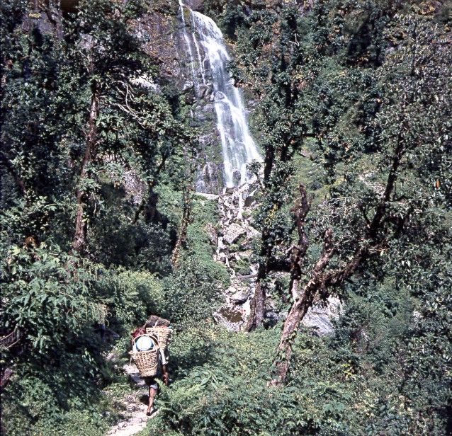
| Nepal is a poor country and the gigantic mountain range of the Himalayas which is exceeding all known dimensions on earth is creating nearly insurmountable problems in the building of a physical infrastructure. Consequently, contrary to the Alps, the Caucasus and the South American Andes, we don’t find railways and roads in this part of the world. The biggest part of Nepal is crisis crosse by an extensive system of foot paths to the remotest corners of the valleys in the High Himalayas where the goods traffic is taking place mainly on human backs of the Nepalese porters, the most frequent profession in this Himalaya kingdom. These foot trails on the approach march to Mount Everest for instance are not resulting in any extraordinarily dangerous experiences. These trails are often miserable, are attached to breathtaking steep mountain slopes and are never on even grounds. The often unstable hair-rising small bridges which are swinging above ice-cold torrential glacier rivers are resulting in greater experiences of fear than real technically difficult ice walls in the High Himalayas. There are nuisances like numerous aggressive leechee in the tropical jungles during our approach walk through the foot hills to the roof of the world. Mountaineering problem situations are not to be expected here. |
![]()
LAPCHI KANG: FROM CHILANGKA 1 900 m INTO THE TAMBA KOSI VALLEY TO GONGAR

Copyright of Map: Research Scheme Nepal Himalaya (Schneider Maps): Lapchi
Kang: 1 : 50 000

East of Chilangka: The Village School of Laduk
Copyright of Photo: Dr. Klaus Dierks

View from Laduk into the Tamba Kosi Valley to the Southeast
Copyright of Photo: Dr. Klaus Dierks

At Laduk we are leaving the east-west running Sangawa Khola
Valley and turn to the North in Direction Rolwaling and Tibet: View into the Tamba Kosi
Valley with the mighty 6 000 m and 7 000 m high Peaks of the Rolwaling (Border with
Tibet) in the Background: The Buddhist Tschörte das to to be negotiated always clockwise
Copyright of Photo: Dr. Klaus Dierks


Between Laduk and Jagat: View into the Tamba Kosi Valley to the
Southeast (left two Photos)
Copyright of Photos: Dr. Klaus Dierks


Between Laduk and Jagat: View into the Tamba Kosi Valley to the
Southeast: From Jagat which is still on 2 200 m we are climbing down into the Tamba Kosi
Gorge to Gongar 700 m
Copyright of Photos: Dr. Klaus Dierks

Gongar in the Tamba Kosi Gorge: Left Photo: View to the North to
the Rolwaling Valley coming from the East: Right Photo: Our Sherpa Guide Nima Lama (right)
and our Cook (Bahadur)(left): At Gongar we have our fifth Night Stop
Copyright of Photos: Dr. Klaus Dierks
![]()
LAPCHI KANG/ROLWALING: FROM GONGAR 700 m IN THE TAMBA KOSI GORGE INTO THE LOWER ROLWALING VALLEY

Copyright of Map: Research Scheme Nepal Himalaya (Schneider Maps): Rolwaling
(Gaurisankar): 1 : 50 000

In Gongar we are entering the steaming and hot Tamba Kosi Gorge:
View to the North
Copyright of Photo: Dr. Klaus Dierks


Images from the steaming and hot Tamba Kosi Gorge: View to the
North (three left Photos) and View to the South (right Photo)
Copyright of Photos: Dr. Klaus Dierks

At Chetchet we are crossing the ice-cold, torrential Tamba Kosi
River on a small dangerous wooden Bridge, only half a metre wide: Nobody who has no good
Head for Heights should dare to negotiate such a Master Piece of Bridge Construction: From
here we are climbing from 800 m to 2 019 m at Simi Gaon (Tibetan: Dakchö) to the East
into the Rolwaling Valley: View to the North
Copyright of Photo: Dr. Klaus Dierks

We have climbed up the first one thousand Altitude Metres from
Chetchet in Direction Simi Gaon: To the left our Sherpa Guide Nima Lama
Copyright of Photo: Dr. Klaus Dierks

Even the Sherpa Children have to carry heavy Loads
Copyright of Photo: Dr. Klaus Dierks

View to the Northwest from Simi Gaon into the Tamba Kosi Gorge
Copyright of Photo: Dr. Klaus Dierks

We have nearly reached Simi Gaon Gompa: Tibetan-Buddhist
Tschörten
Copyright of Photo: Dr. Klaus Dierks

View to the West from Simi Gaon Gompa into the Tamba Kosi Gorge
Copyright of Photo: Dr. Klaus Dierks

The big Mani (Prayer) Wheel in the Gompa of Simi Gaon 2 100 m
with our Sherpa Guide Nima Lama: Simi Gaon is our sixth Nightstop
Copyright of Photo: Dr. Klaus Dierks

From Simi Gaon we have to climb another 1 000 m through the Rain
soaked Mountain Forests of the Lower Rolwaling: Nima Lama and some of our Porters at
a Buddhist Mani Wall which has to be passed clockwise
Copyright of Photo: Dr. Klaus Dierks


The Forest Settlement Shakpa 2 850 m
Copyright of Photos: Dr. Klaus Dierks

Some Mountain Forests in the Lower Rolwaling were many Years ago
destroyed by a Forest Fire caused by Lightening
Copyright of Photo: Dr. Klaus Dierks

Orchids in the Mountain Forests in the Lower Rolwaling
Copyright of Photo: Dr. Klaus Dierks


The Hair Rising Path along vertical Rock Faces from Shakpa to
Beding: Somewhere in the Mountain Forests we have our seventh Nightstop
Copyright of Photos: Dr. Klaus Dierks
![]()
ROLWALING: FROM THE LOWER ROLWALING VALLEY TO BEDING, THE CAPITAL OF THE ROLWALING

Copyright of Map: Research Scheme Nepal Himalaya (Schneider Maps): Rolwaling
(Gaurisankar): 1 : 50 000

At 3 200 m we have reached the High Himalayas in the Rolwaling:
First Glimpse to Gaurisankar (The Holy Jomo Tseringma of the Tibetans) 7 146 m, once
regarded to be the highest Peak in the World: View to the Northeast
Copyright of Photo: Dr. Klaus Dierks


In the East - one by one - the high Peaks of the Rolwaling are
coming up: View on Kang Nachugo 6 735 m
Copyright of Photos: Dr. Klaus Dierks


We have reached Beding 3 693 m, the Capital of the Rolwaling:
View to the East in Direction Trashi Laptsa and the Border Peaks to the Khumbu
Copyright of Photos: Dr. Klaus Dierks


Beding: View to the Northwest in Direction Gaurisankar: In the
Middle of the Photo is the Big Tschörten and the Gompa (Buddhist Monastery) of Beding
Copyright of Photos: Dr. Klaus Dierks

Beding: In one of these Sherpa Houses we spent our eighth and
ninth Nightstops
Copyright of Photo: Dr. Klaus Dierks


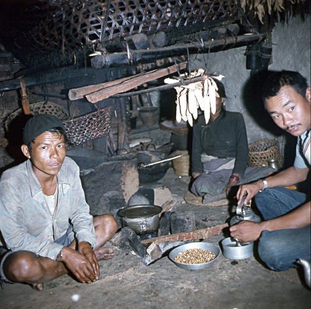
In Beding our Porters from the first Exepdition Shift, mainly
from the Nepalese Groups of the Sunwar and the Tamang, are paid out in our Sherpa House.
From here onwards we used Sherpa Porters (right Photo)
Copyright of Photos: Dr. Klaus Dierks


Images from the Beding Gompa: The Big Prayer (Mani) Wheel in the
Gompa (left Photo)
Copyright of Photos: Dr. Klaus Dierks


Images from the Beding Gompa: The Interior of the Dukhang
(Prayer Hall): The left Photo shows the Kangschur: The 108 (Holy Number in Tibetan
Mythology) Volumes of the Tibetan-Buddhist "Bible"
Copyright of Photos: Dr. Klaus Dierks


The Gaurisankar (The Holy Jomo Tseringma of the Tibetans) 7 146
m seen from Beding: View to the Northwest
Copyright of Photos: Dr. Klaus Dierks
![]()
ROLWALING: FROM BEDING TO NA, THE TSHO ROLPA AND THE TRAKARDING GLACIER

Copyright of Map: Research Scheme Nepal Himalaya (Schneider Maps): Rolwaling
(Gaurisankar): 1 : 50 000

On a frosty October Morning 1980 we leave Beding to the East in
order to tackle some of the most difficult Mountain Crossings, Glaciers and Icefalls
on Earth: View from the big Tschörten at Beding to the East in Direction Na
Copyright of Photo: Dr. Klaus Dierks


We left Beding in an easterly Direction to the Sherpa Village
Na: View to the Northwest with the Rolwaling Chhu (River) in the Forefront and the
Gaurisankar in the Background
Copyright of Photos: Dr. Klaus Dierks

The Sherpa Settlement Dokare 4 086 m between Beding and Na with
Gaurisankar in the Background: View to the West
Copyright of Photo: Dr. Klaus Dierks


The Sherpa Settlement Dokare with Gaurisankar in the Background
(Middle Photo)
Copyright of Photos: Dr. Klaus Dierks

Bamongo 6 400 m from Dokare: View to the East
Copyright of Photo: Dr. Klaus Dierks

Shortly before Na we had the first View of Chobutse (Tsoboje) 6 689 m, one of the
most beautiful Peaks in the World: View to the East
Copyright of Photo: Dr. Klaus Dierks

Shortly before Na we came across this huge Rock which is over
and over engraved with Tibetan-Buddhist Mantras (Magic Words)
Copyright of Photo: Dr. Klaus Dierks


Na 4 183 m is only inhabited in the Summer Season (Summer
Village: In Tibetan Phu or Yarsa): The Sherpa live here in the Summer (in the Winter they
return to Beding) with their Yak Flocks and crop Potatoes and Barley: Left Photo: View to
the Nortwest on Bamongo: Right Photo: View to the East to Chobutse
Copyright of Photos: Dr. Klaus Dierks


Sherpa at Na
Copyright of Photos: Dr. Klaus Dierks

Na: View to the West
Copyright of Photo: Dr. Klaus Dierks

Na: View to the East to Chobutse
Copyright of Photo: Dr. Klaus Dierks

Our Camp at Na: View to the West
Copyright of Photo: Dr. Klaus Dierks

View on Chobutse, east of Na: View to the East
Copyright of Photo: Dr. Klaus Dierks

Klaus Dierks at the Beginning of the Ripimo Shar Glacier (End
Moraine), east of Na
Copyright of Photo: Dr. Klaus Dierks

On our Way from the Ripimo Shar Glacier to the Glacier Lake Tsho
Rolpa: View to the West in Direction Na
Copyright of Photo: Dr. Klaus Dierks


The Glacier Lake Tsho Rolpa is situated on an Altitude of 4 534
m. We were fighting our Way on the northern Side three hunderd Metres above the Lake Level
over instable Moraine Slopes which continuously were moving and sending down Stone
Avalanches. This Section was one of the most strenuous and dangerous on the whole Trek.
One wrong Step would mean a "Slip into Eternity": View to the East to the
Trakarding Glacier and the Peak Biphera-Go Shar 6 700 m at the Border between the
Rolwaling and the Khumbu in the Background
Copyright of Photos: Dr. Klaus Dierks

From the Moraine Slopes above the Glacier Lake Tsho Rolpa we had
to climb down to the Trakarding Glacier which led us to the Drolambao Icefall
Copyright of Photo: Dr. Klaus Dierks

From the Moraine Slopes above the Glacier Lake Tsho Rolpa: View
back to the West to Tsho Rolpa and Kang Nachugo 6 735 m in the Background
Copyright of Photo: Dr. Klaus Dierks


Images from the Trakarding Glacier: We had to fought our Way
over Millions of "Rolling Stones" to the East to the Drolambao Icefall
Copyright of Photos: Dr. Klaus Dierks


We approached the End of the Trakarding Glacier and have nearly
reached the Drolambao Icefall: Lunch Rest on the Glacier
Copyright of Photos: Dr. Klaus Dierks
![]()
ROLWALING/KHUMBU: FROM THE TRAKARDING GLACIER VIA THE DROLAMBAO ICEFALL TO THE TRASHI LAPTSA PASS 5 755 m

Copyright of Map: Research Scheme Nepal Himalaya (Schneider Maps): Rolwaling
(Gaurisankar): 1 : 50 000


At the Foot of the Drolambao Icefall 5 000 m, under a safe
Rockface which protected us against the continuously thundering Snow and Ice Avalanches,
we prepared our Night Camp: The whole Night we had the frightening Experience of the
Thunder of Avalanches around us
Copyright of Photos: Dr. Klaus Dierks


The next Morning we tried to fight our Way through the Drolambao
Icefall, without appropriate Ropes and without the Ice Screws which our
Sherpa Guide Nima Lama had forgotten in Kathmandu: It was only logic that we lost and had
to return
Copyright of Photos: Dr. Klaus Dierks

After the lost Battle at the Drolambao Icefall we built again
our Camp below the protecting Rock
Copyright of Photo: Dr. Klaus Dierks

Edelweiss at a protected Spot at an Altitude of 5 000 m at the
Foot of the Drolambao Icefall
Copyright of Photos: Dr. Klaus Dierks
ROLWALING: AFTER OUR FAILURE AT THE DROLAMBAO ICEFALL WE HAD AGAIN TO FIGHT OUR WAY BACK ON THE TRAKARDING GLACIER AND THE INSTABLE SLOPES AT THE TSHO ROLPA TO NA - THERE WE MET A FRENCH EXPEDITION WHICH HAD ALL THE EQUIPMENT AND INVITED US TO RETURN TO THE DROLAMBAO ICEFALL
We had to return from Drolambao Icefall, we had lost, we had failed, all this was beyond our means. The bitter taste of defeat, the terrible exhaustion in 5 200 m altitude, the feeling that we haven’t been treated fairly by nature, - all these were limit experiences. We were passing through all phases of desperation but sooner or later we felt calm and peaceful and we knew that we had to accept the inevitable. Here we had reached the end as well our limits.
After the Defeat at the Drolambao Icefall our disappointed
Sherpa Crew prepared to descent to the Trakarding Glacier in order to cross it to the
southern Side
This Time we followed the southern Slopes of the Trakarding
Glacier in order to avoid this nasty Glacier: On our Way to the Tsho Rolpa we climed a
Peak Kyidug Kongma 5 259 m: View from the Kyidug Kongma to the East to
the Drolambao Icefall (left) and Biphera-Go Shar 6 700 m at the Border
between the Rolwaling and the Khumbu
Our Night Camp in a Sherpa Hut at the Base of the Kyidug Kongma
On our Way from the Kyidug Kongma Base we
crossed the End Moraine of the Trakarding Glacier: View to the West to the Kang Nachugo 6
735 m in the Background
On our Way from the Kyidug Kongma Base we again
climbed up to 5 000 m in order to avoid the treacherous instable Slopes of the Tsho Rolpa:
View to the West to the Tsho Rolpa and the Kang Nachugo 6 735 m in the Background: From
here we returned to Na where we met another Himalaya Expedition under the Leadership of
Gil Robberts from Kathmandu, Pierre Vernay from France and the highly experienced Norbu
Sherpa who knows the Trashi Laptsa well. They took us back with appropriate Equipment to
the Drolambao Icefall |
ROLWALING/KHUMBU: FOR THE SECOND TIME: FROM THE TRAKARDING GLACIER VIA THE DROLAMBAO ICEFALL TO THE DIFFICULT TRASHI LAPTSA PASS 5 755 m AND THE DESCENT INTO THE KHUMBU
Copyright of Map: Research Scheme Nepal Himalaya (Schneider Maps): Rolwaling
(Gaurisankar): 1 : 50 000


For the second Time our combined Expedition attacked the
horrible Trakarding Glacier: Lunch Rest on the Glacier: This time we also had some female
Sherpani-Porters (left two Photos with Didi Dolma)
Copyright of Photos: Dr. Klaus Dierks

We have reached again the Drolambao Icefall: The Hour of Truth
had come
Copyright of Photo: Dr. Klaus Dierks

In the Morning of 13.10.1980, before we climbed into the
Drolambao Icefall: View to the East to Biphera-Go Shar 6 700 m
Copyright of Photo: Dr. Klaus Dierks

Didi Dolma in the Drolambao Icefall
Copyright of Photo: Dr. Klaus Dierks


In the Drolambao Icefall
Copyright of Photos: Dr. Klaus Dierks

In the Drolambao Icefall: Pierre Vernay belays the Members of
our Expedition
Copyright of Photo: Dr. Klaus Dierks


After we had successfully mastered the Drolambao Icefall we had
a first Glimpse on the Drolambao Glacier and the Trashi Lapta with Tengi Ragi Tau 6 943 m
in the Background
Copyright of Photos: Dr. Klaus Dierks

On the Drolambao Glacier: Even here and in-spite of Frostbite in
her Feet, Didi Dolma looks after herself
Copyright of Photo: Dr. Klaus Dierks

On the Glaciers of the Trashi Laptsa we have to put on our
Crampons
Copyright of Photo: Dr. Klaus Dierks

View to the Northeast to the Trashi Laptsa at the Foot of Tengi
Rangi Tau 6 943 m
Copyright of Photo: Dr. Klaus Dierks


From the Drolambao Glacier in the Background we climb up the
Trashi Laptsa to an Altitude nearly 6 000 m: View to the Northwest into Tibet: Here Eric
Shipton discovered 1951 strange Tracks of the Yeti Miteh, the "Rock
Human" of the Sherpaland (Migö in Tibetan)
Copyright of Photos: Dr. Klaus Dierks

Our Camp in nearly 6 000 m Altitude on the Trashi Laptsa at the
edge of a huge Glacier Crevasse and the southern Slope of the Tengi Ragi Tau
Copyright of Photo: Dr. Klaus Dierks

First View from the Trashi Laptsa to the East into the Khumbu
and the Khumbu Himal with Mount Everest in the Background
Copyright of Photo: Dr. Klaus Dierks
In my diaries of the 1980 Rolwaling-Khumbu Trekking Expedition I noted the following on the Drolambao Icefall and the Trashi Laptsa:
| During our Namibia Himalaya Expedition 1980 we follow the
most difficult and impassable but most beautiful route to Mount Everest. We are moving
through the Rolwaling Himalaya which is situated at the boundary between Nepal and Tibet
with its very old pure lamaistic culture. We intend to traverse the ill-famed Trashi
Laptsa which was once called the most difficult mountain crossing in the world by Sir
Edmund Hillary. The Sherpas from Beding, the main village of the Rolwaling Himal with its
ancient Tibetan monastery, are warning us about the unpredictable dangers of Trashi Laptsa
which is nearly reaching 6000 m in altitude. Especially during the post monsoon period
which is during October and November it is not advisable to cross the pass due to the
sudden changes of weather and the danger of blizzards. Specific dangers are its
treacherous snow conditions and the permanent hazard of avalanches. For a not very well
equipped expedition like the Namibia Himalaya Expedition 1980, however, a vertical
overhanging ice wall int eh Drolambao icefall, just below the Trashi Laptsa represents a
grave problem. Before we reach this infamous icefall at which many well equipped
expeditions have failed in the past we have to cross the Trakarding glacier first. This
crossing represents a two day sweating glacier exertion. During this exercise we are
continuously threatened by rockfall and snow avalanches which come down every couple of
minutes from the 6000 m to 7000 m high mountains above us. It is like Russian Roulette to
cross these constantly moving unstable slopes. Below us steep ice walls are falling almost
vertically to a frozen lake. Large boulders come whistling down toward us like artillery
projectiles. Our Sherpas are spitting against the approaching boulders and are muttering a
hurried "Om mani padme hum" to appease the demons of the Himalayas. It
doesn’t represent mountaineering delight any more to safeguard ourselves before the
rockfall with painfully lounges in altitudes above 5000 m. Glaciers in the Himalayas are rubble covered monsters, a ragged, bizarre, chaotic moon landscape which is difficult to traverse. We are harassing ourselves in crossing these rubble covered ice mountains of the Trakarding. Below ourselves the rubble stones are continuously rolling away, the step is losing in rhythm and is becoming distressingly irregular. We are groping our way along deep glacier crevasses and deep gigantic ice craters filled with green icewater. During the day this grandiose ice wilderness can develop tropical temperatures. The sun which is shining with incredible intensity changes the icy world into a hell of white heat, and the ill-famed glacier lassitude starts to affect the human being. As soon as the sun is setting behind the ice giants it is becoming very cold and the coldness is falling out of the universe which we have reached so closely. Somewhere in this icy uninhabitable primeval wilderness we are to erect our camp. We are sleeping in small coffin like double tents on a approximately ten millimetres thick rubber mat on the bare ice which is smelting according to our bodily structure during the night. Our Sherpas are trying to cook the frugal dinner on our primus stoves. In great altitudes it is not easy to prepare warm meals because water is boiling at 70 B to 80B C in these heights. For this reason rice and potatoes, the staple food of the Sherpa people, cannot be sufficiently cooked. We are eating day for day boring "chaura", an especially treated rice or tsampa, the Tibetan form of coarse barley flour which are stirred to a luke warm porridge. Additional we have "pika tscha", the ill-reputed Tibetan buttered tea, of which the ingredients are Chinese tea, salt, soda and mostly rancid yak butter which is in most cases thoroughly mixed with yak hairs. One could come to the conclusion that this meatless almost vegetarian one-sided diet in combination with permanently required physical heavy duty stress will cause a hallucination for Namibian king size steaks. But strange enough these hunger hallucinations don’t bother us. We are only noting that we are continuously weakening in altitudes where our bodies cannot anymore generate themselves.After sunset we can only move into our tents and crawl into our sleeping bags which are hopefully quickly warming up. In the nights one is put before grave decision conflicts to go out into this icy cold or not when nature calls. I am remembering one night at Cho Oyu during March 1982. I was forced to leave the warm sleeping bag and to go out during a heavy blizzard. Every couple of seconds the lightning of approaching monsoon flashed through the almost horizontally pelting snowline, an incredible although for the weather during the next couple of days unfavourable spectacle. The climbing in and out the ice covered sleeping bag with nearly all clothes is a puffing effort in this altitude and awakens normally the partner and takes a couple of minutes. But it is still worse to slip into the deeply frozen double mountaineering boots. This exercise can take up to twenty moaning and swearing minutes. It is bad enough to spend these nightmarish nights in a close coffin like tent on bare ice and snow. During these long cold nights the interior of the tent is covered with ice which is falling into one’s face with each labourious breath. In regular intervals roaring snow- and ice avalanches are coming off the icefall and the gigantic peaks surrounding us. Every time the blast is shaking our tent and the glacier ice is starting to tremble below us. In these gloomy dark nights on the top of the world this can be a real horrifying experience. Difficult gasping heavy breathing, the movements of the partner, doubts, fear, loneliness, nightmares which are most probably caused by the lack of oxygen and insomnia - nights in the Himalayas, this experience is likewise part of a Himalaya expedition. Normally we are getting up before five o'clock. Usually the first thought is the not very encouraging but famous quotation which is known to every mountaineer in the Himalaya and was made by F S Smythe on the British Everest Expedition 1931: "Another bloody day". Outside it is ice cold, maybe twenty to thirty degrees below freezing point, but the weather is crystal clear during the early mornings in the pre- as well the postmonsoon periods. The giant mountains around us are clearly visible in the quickly withdrawing down. The stars above us are shining point blank gloomy with luminary intensity. In Namibia, in the desert Namib, the stars are not shining brighter than here. The tracks of avalanches we have heard during the night are now also clearly visible and are indicating the tremendous difficulties in front of one’s eye because we have to climb through this avalanche ravaged steep wall this morning. Our Sherpas are serving lukewarm early morning tea which has been made out of smelted snow and some biscuits which we are swallowing through our permanently sore throats. Our Sherpa guide of the Himalaya expedition 1980, Nina Lama, is praying continuously his Tibetan Buddhist prayers in monotonous sing-song since four o’clock in the morning. Shortly before our departure the devout Sherpa burns down some fumigating candles in front of a quickly erected rock altar to pray for support to the Tibetan mountain goddess Tseringma to help us to pass safely the dangerous Trashi Laptsa. Departing with stiff knees and surprisingly small looking and surprisingly heavy weighting rucksacks all uncertainties and fears are falling away. At first we have to cross the glacier below the icefall. The deeply frozen snow bridges are carrying us safely across the fathomless crevasses. Above us the sun is shining already onto the sky-high towering peaks. Down here at 5200 m altitude everything is still enveloped in blueish cold. Parts of the rock wall which we have to climb are vertical and covered with ice but have fortunately sufficient footholds. The fixed ropes which our Sherpas have attached are safeguarding the most difficult pitches for our porters. After three hours we have overcome the first two hundred and fifty metres of steep wall climbing. After that a nearly hundred metre high ice channel nearly 70 degrees steep, is following. This couloir is approximately three metres wide and here everything is howling down what the icefall above holds in readiness for us: Frightening rockfall, powder snow avalanches and terrible slippery rock covered with ice. It is the hell for the porters and for us. Again and again we are pulling ourselves together, stimulating ourselves and one or other time all sweating exertion is coming to an end. We have reached the end of the pitch. Above us ragged ice seracs are hanging in impossible angles. Any moment these unstable monsters can collapse and bury us underneath. The rockfall, at least, comes in this icy world to an end. Therefore an chilly wind is freshens up. Our bodies are numb with cold and our clothes are beginning to freeze. The icefall is looking impossible. Here, as I know, even Hillary has failed. During our climbing exercise all these disquieting thoughts are going through my head. The ice is brittle and we are not able to knock proper steps with our ice axes into the overhanging, greenishly shining ice wall. Each axe blow causes a small ice avalanche. Unfortunately we have no ice screws to our disposal to anchor our ropes. With ice covered faces looking like icy walruses we are battling like madmen, gasping and puffing and shouting for each other. It is to no avail. We haven’t got the right equipment to overcome this tremendous icefall.- We have to return, we have lost, we have failed, all this is beyond our means. The bitter taste of defeat, the terrible exhaustion in 5500 m altitude, the feeling that we haven’t been treated fairly by nature, - all these too are limit experiences. We are passing through all phases of desperation but sooner or later we feel calm and peaceful and we know that we have to accept the inevitable. Here we have reached the end as well our limits. To this part of the world we will never return. We have to abandon the whole undertaking. This means a formidable realisation for us. We are battling back across the terrible avalanche- and rockfall sections which we have passed some days ago. We are passing the deep valley of defeat in the full sense of the word, and we are returning to the world of human beings in Beding, the main village of the Rolwaling Sherpas. No hope is left to bring the expedition to a successful end. But in some way or other a sound stubbornness is upholding us. In Beding we obtain the missing ice screws from a Sherpa and again hope is bursting into flame like a veldfire. We are beginning to live again, so intensively and actively as one can live only between these huge peaks. Again we are fighting our way back to the Drolambao icefall, passing the difficult avalanche section during two long exhausting days. This time we do overcome the icefall which we had abandoned the first time. Our way is free to Mount Everest. We have done what we have wanted to do. Success and defeat, happiness and mortal terror are close to each other in the Himalayas. The mountains are dictating the conditions, not the human beings. Our fate is not dependant on personal ability and condition. Hanging on a rope above the unfathomable icy abyss in the icefall I am slipping and falling into this tiny instrument of mountaineering. The thoughts flashing through the brain in the fraction of a not measurable instant of time do enclose nothingness and the full life, a further limit threshold has been crossed. That our small Namibia Himalaya Expedition 1980 has attacked the Trashi Laptsa twice and 5that we have climbed it successfully the second time is not so much a success but victory against ourselves. In the Himalayas success has no meaning at all. The Lama Rimpoche of the monastery Thame in Khumbu dedicated to me wise motto: "The path is the destination". One of the gravest dangers on any expedition into the Himalayas are besides natural risks like crevasses on glaciers, avalanched, soft snow, inclemency of the weather and others mainly death by exhaustion and the ill-famed "Acute High Altitude Sickness". This unpredictable disease can occur in altitudes as low as three- to four thousand metres and will be caused by the decreasing partial oxygen pressure which is resulting in considerable disturbances in the human body. One has to differ between mild and life endangering heavy symptoms of the High Altitude Sickness. The mild symptoms like headache, nausea, insomnia, loss of appetite, breathlessness as well as altitude cough are suffered by each high altitude mountaineer. These symptoms disappear usually after a few weeks due to acclimatisation. Optimally an eighty five percent adaption to high altitudes can be reached after five weeks of staying in heights above 5 000 m.. The grave symptoms like High Altitude Pulmonary Edema and High Altitude Cerebral Edema are representing nearly always a deadly risk. No scientific theory regarding High Altitude Sickness has been established yet. It is a gloomy and not calculated disease which even can strike at mountaineers with optimal condition and high altitude experience. Up to this day no medical precaution is known. Drugs like Azetazolamid can at their best combat the mild symptoms. The optimal prophylaxis for each expedition is still a well planned phase of acclimatisation. It should be considered in the course of said acclimatisation to estimate one week for every thousand altitude metres beyond four thousand metres. The time of adaption and preparation at home serves another purpose as well. To climb in high altitudes one needs great willpower due to the fact that normal living and breathing alone without any physical exertion represents already considerable suffering. The necessary psychological power in generating this willpower must be build during long periods. Only in that way, during the critical phases of an expedition, compacted energy and fitness can be generated. This dense energy field will remain even in great heights. Apart from the constant threat of disease and accidents which without the possibility of any rescue assistance constitutes in itself a great psychological stress, there are other problems on any Himalaya expedition. In times of a permanent state of exhaustion in an environment which is regarded by oneself and everybody else as hostile, one will certainly react differently as one would react at home. This different behaviour comes to light particularly in the social relations with one’s co-climbers on such expedition. Conflict situations are almost unavailable. The closeness of the companionship during long periods which often are lasting for several month and in a environment of gigantic dimensions and continuous states of danger causes stresses which during the expedition can only be solved with difficulties. Psychologists who have dealt with such problem situation on Himalaya expedition speak about the three physiological phases of the high altitude mountaineer. The first phase is the "blinker stage". It appears normally during the approach into the base camp in altitudes to approximately 5000 m. Even in this stage of problem free mountaineering the mountaineer experiences a physical and psychological stress situation. It is not the first indication of mild symptoms of High Altitude sickness or the blisters at the mountaineers feet, the continuously attacking leechee, the frugal food, the normal strain on miserable frustrating trails but fears, uneasiness and doubts. The mountaineer is almost cocooned in this framework of worrying thoughts which are caused by the fear of the forthcoming limit state experiences. The next phase is the "champagne cork stage" which occurs usually in altitudes between 5000 m and 6000 m. Normally well balanced and peace loving personalities develop here remarkable irascibility attacks. One is again and again amazed from where one is taking the power to these outbursts of fury in this thin air. One is, however, well advised to ignore these "champagne cork attacks". These attacks have not a great significance and are indicating purely that the diminishing aveolaric partial oxygen pressure begins to affect the brain cells of the mountaineer. The most dangerous phase is the euphoria phase, the "Hallelujah Stage" which occurs in real great heights, in the death zone. In this phase the mountaineer losses any relation to reality and to performance and condition regarding his own person. Here it can occur that in nearly 7000 m altitude one is passing a glacier full with crevasses without the usual rope security. The latter happened to me at Mera Peak in the Hongu south of Mount Everest. Under these circumstances inexplicable abandonment of co-climbers, mysterious occurrences which are responsible for so many mountaineering tragedies in the history of climbing in the Himalayas. It is by all means possible that these occasions which are deeply rooted in the human soul are more dangerous that the unpredictable weather in the Himalayas, avalanches and crevasses. Each mountaineer is well advised to be aware of these correlations. |
![]()
ROLWALING/KHUMBU: THE DESCENT FROM THE TRASHI LAPTSA PASS DESCENT INTO THE KHUMBU TO THAME OG

Copyright of Map: Research Scheme Nepal Himalaya (Schneider Maps): Khumbu
Himal (Nepal): 1 : 50 000
In my diaries of the 1980 Rolwaling-Khumbu Trekking Expedition I noted the following on the Drolambao Icefall and the Trashi Laptsa:
Each expedition into the Himalayas is falling into two phases. The first phase serves the slow and well planned time of acclimatisation. This is dictated by the necessity to adapt to high altitudes to avoid the grave and live threatening problem of the Acute Mountain Sickness. The second phase consists of the actual expedition. During the first Namibia Himalaya Expedition 1980 sufficient adaption time was obtained by means of the long approach walk from Kathmandu via the Rolwaling to the Khumbu, the region south of Mount Everest. |
In 1984 my wife Karen and myself tackled the Trashi Laptsa from the Khumbu side in order to climb the Peak Pacharmo 6 272 m. The photos from the 1984 Trekking Expedition between Thame and the Trashi Laptsa will be incorporated into this documentation.

My Wife, Karen Dierks, née Von Bremen, on the Trashi Laptsa:
View to the East in Direction of our Camp Site: We used the same Camp Site as during
October 1980
Copyright of Photo: Dr. Klaus Dierks


Our Camp Site on the Trashi Laptsa: October 1984: The big
Crevasse of 1980 had closed nearly completed during these four Years
Copyright of Photos: Dr. Klaus Dierks


Pacharmo 6 272 m south of the Trashi Laptsa: The Destination of
our Trekking Expedition 1984
Copyright of Photos: Dr. Klaus Dierks

In the Night before the Pacharmo Climb
the"Acute High Altitude Sickness" with the beginning of a "Cerebral
Enema" struck me. Although I was nearly not able to move, I wanted to continue
("Hallelujah Stadium"), but my Wife forced me to abandon Pacharmo and to abseil
immediately. This surely saved my Life: Klaus Dierks before the Departure to lower
Altitudes
Copyright of Photo: Dr. Klaus Dierks


Khumbu: During the Abseil through the Trashi Laptsa Icefall:
View to the East
Copyright of Photos: Dr. Klaus Dierks

Khumbu: The Descent from the Trashi Laptsa Icefall: View to the
West to the Trashi Laptsa and Tengi Ragi Tau: October 1980
Copyright of Photo: Dr. Klaus Dierks

Khumbu: The Descent from the Trashi Laptsa Icefall: View to the
East to the Khumbu Himal: October 1980
Copyright of Photo: Dr. Klaus Dierks

Khumbu: The Descent from the Trashi Laptsa Icefall: View to the
West to the Trashi Laptsa with Didi Dolma: October 1980
Copyright of Photo: Dr. Klaus Dierks


30.10.1984: Our next Camp (Trashi Laptsa Base Camp) was at an
Altitude of 5 200 m which immediately relieved my "Acute High Altitude
Sickness". The left Photo shows our four female Sherpani porters and our
Sherpa Guide Dawa Thondup during the Ascent to Trashi Laptsa: This same Evening we heard
in the News that Tragedy hat struck India: Indian Prime Minister Indira Ghandi was killed
by her Sikh-Bodyguards
Copyright of Photos: Dr. Klaus Dierks

Our four female Sherpani Porters preparing the Camp at Trashi
Laptsa Base Camp: 1984
Copyright of Photo: Dr. Klaus Dierks


Khumbu: Our Camp at Trashi Laptsa Base Camp with my Wife Karen:
1984
Copyright of Photos: Dr. Klaus Dierks
View from our Camp to the Northwest to Panayo Tippa 6 696 m, one
of the most beautiful Peaks in the Himalaya
Copyright of Photo: Dr. Klaus Dierks

View from our Camp to the Southwest to the Teng Kangpoche Range
6 500 m
Copyright of Photo: Dr. Klaus Dierks

From the Trashi Laptsa Glacier Camp we climbed down to the Foot
of the Trashi Laptsa Glacier 4 800m: View to the East to the Teng Kangpoche Range and the
Khumbu Himal (Left Middle)
Copyright of Photo: Dr. Klaus Dierks


Our Camp at the Foot of the Trashi Laptsa Glacier: Left Photo
shows our Sherpa Guide Dawa Thondup (1984 Trekking Expedition)
Copyright of Photos: Dr. Klaus Dierks


In the Sherpa Settlement Thengpo 4 320 m (only inhabitated
during the summer season) we have reached agin the World of Humans, after we had left the
Death Zone of the High Himalaya: View to the West to the Trashi Laptsa (two left Photos)
Copyright of Photos: Dr. Klaus Dierks

Gentians in Thengpo 4 320 m
Copyright of Photo: Dr. Klaus Dierks

In Thengpo we have entered again the human World of the Tibetan
Buddhism with Mani Walls and Prayer Flags: View to the West to the Trashi Laptsa
Copyright of Photo: Dr. Klaus Dierks

Yaks near Thengpo: View to the West to the Trashi Laptsa
Copyright of Photo: Dr. Klaus Dierks


"Porter Lunch" between Thengpo and Thame Gompa: Left
Photo: Our Sherpa Guide Dawa Thondup (Trekking Expedition 1984) and our four Sherpani
Porters: Right Photos: My Wife Karen Dierks, née Von Bremen
Copyright of Photos: Dr. Klaus Dierks

View to the East to the famous Buddhist Thame Gompa (the other
famous Tibetan Buddhist Sherpa Monastery is Tengpoche) with the Holy Peak of the Khumbu
Himal "Khumbui Yul Lha 5 761 m" in the Background
Copyright of Photo: Dr. Klaus Dierks


View to the East to Thame Gompa
Copyright of Photos: Dr. Klaus Dierks


View to the West from the Thame Gompa
Copyright of Photos: Dr. Klaus Dierks

View to the South from the Thame Gompa to the Khumbu Himal south
of Namche Bazar with Tramserku 6 608 m (right) and Kang Tega 6 685 m (left)
Copyright of Photo: Dr. Klaus Dierks

Entrance to the Thame Gompa with our Sherpa Guide Nima Lama
(Trekking Expedition 1980) to the Left
Copyright of Photo: Dr. Klaus Dierks


Monks of the Thame Gompa: October 1980
Copyright of Photos: Dr. Klaus Dierks


In the Interior of the Thame Gompa in the Dukhang (Prayer Hall)
Copyright of Photos: Dr. Klaus Dierks


In the Interior of the Thame Gompa in the Dukhang (Prayer Hall):
The Head Lama - Rimpoche - Tenpe Gyaltsen: October 1980
Copyright of Photos: Dr. Klaus Dierks

On the Way from the Thame Gompa to the Sherpa Village Thame Og:
View to the South to the Khumbu Himal with Tramserku 6 608 m (right) and Kang Tega 6 685 m
(left)
Copyright of Photo: Dr. Klaus Dierks

Below Thame Gompa lies the Sherpa Village Thame Og 3 800 m: View
to the West to Thengpo
Copyright of Photo: Dr. Klaus Dierks


The Main Living Room in a Sherpa House at Thame Og: Left Photo
shows our Sherpa Guide Dawa Thondup (Trekking Expedition 1984)
Copyright of Photos: Dr. Klaus Dierks
![]()
KHUMBU: FROM THAME OG TO PANGPOCHE VIA NAMCHE BAZAR AND TENGPOCHE

Copyright of Map: Research Scheme Nepal Himalaya (Schneider Maps): Khumbu
Himal (Nepal): 1 : 50 000

Copyright of Map: Sherpaland: National Geographic, May 2003
From the Thame Gompa we walked to the Sherpa village Thame Og and from there via Dramo to the south to Namche Bazar (Nauche) 3 440 m, the main settlement of the Sherpaland. Above Namche Bazar to the north are the twin Sherpa villages Kunde and Khumjung 4 150 m. From there we descended to the east into the gorge of the Imja Khola and on the other side of the river climbed up the 750 m to Tengpoche Gompa, the spiritual point of gravity of the Sherpaland.


The Sherpa Village Dramo 3 640 m between Thame Gompa and Namche
Bazar (Nauche): View to the North
Copyright of Photos: Dr. Klaus Dierks

Sherpa Children in Dramo: October 1980
Copyright of Photo: Dr. Klaus Dierks

Tschörte (Buddhist Shrine) between Dramo and Namche Bazar:
October 1980
Copyright of Photo: Dr. Klaus Dierks


Himalaya Pines between Dramo and Namche Bazar: View to the
Tramserku in the South (left Photo) and to the West (Kongde Ri Range)(right Photo)
Copyright of Photos Dr. Klaus Dierks

Rock Face with Tibetan-Buddhistic Mantras between Dramo and
Namche Bazar: View to the North
Copyright of Photo: Dr. Klaus Dierks


Namche Bazr 3 440 m is the economic and administrative Centre of
the Khumbu Rgion: Middle Photo: View to the North: Above the Edge are the two Twin Sherpa
Villages Khunde (to the West) and Khumjung (to the East)(both Villages not visisble):
Right Photo: View to the West to the Konge Ri Mountains 6 187 m
Copyright of Photos: Dr. Klaus Dierks


The Sherpa Village Khunde 4 150 m: View to the West to the
Kongde Ri Mountains (left Photo) and to the East to Kang Tega (right Photo)
Copyright of Photos: Dr. Klaus Dierks

Khunde: Preparations to our Trashi Laptsa Trekking Expedition
October 1984 with our Sherpa Guide Dawa Thondup to the Left with his Daughter, one of our
Sherpani Porters and his Grandson Ang Tsering
Copyright of Photo: Dr. Klaus Dierks

Dawa Tsondup's Gradson Ang Tsering: October 1984
Copyright of Photo: Dr. Klaus Dierks

The Tschörte of the Sherpa Village Khumjung 4 150 m: View to
the West to the Kongde Ri Mountains
Copyright of Photo: Dr. Klaus Dierks

The Way from Khumjung 4 150 m to Phunki (Bridge over the Imja
Khola) 3 250 m from where the steep Footpath to Tengpoche 3 867 m begins: View to the East
to Kang Tega
Copyright of Photo: Dr. Klaus Dierks


Tengpoche is the Spiritual Point of Gravity of the Sherpaland:
The Big Tschörte of Tengpoche with Tramserku (left) and Kang Tega (right) in the
Background: View to the South
Copyright of Photo: Dr. Klaus Dierks

Tengpoche: View to the North into the Gokyo Valley in Direction
Cho Oyu 8 153 m
Copyright of Photo: Dr. Klaus Dierks


From Tengpoche we had the first Glimpse of Chomolungma - Mount
Everest 8 850m (the small Peak behind the Nuptse South Face with the Lhotse 8 501 m on the
right Side): View to the East
Copyright of Photos: Dr. Klaus Dierks


Tengpoche with Amai Dablam 6 856 m in the Background: View to
the Southeast
Copyright of Photos: Dr. Klaus Dierks

The Dukhang (Praying Hall) of the Tengpoche Monastery: November
1980
Copyright of Photo: Dr. Klaus Dierks


The Entrance to the Dukhang of the Tengpoche Monastery: View to
the South to Kang Tega
Copyright of Photos: Dr. Klaus Dierks

Praying Wheels in the Tengpoche Monastery: November 1984
Copyright of Photo: Dr. Klaus Dierks


Praying Buddhist Monks praying in the Dukhang of the Tengpoche
Monastery with the Lamaistic Bass Trombone, the Dungchen (left two Photos): November 1980
Copyright of Photos: Dr. Klaus Dierks

The Lhokang (Hall of Buddhist-Tibetan Gods) in the Tengpoche
Monastery: November 1980
Copyright of Photo: Dr. Klaus Dierks

We met Reinhold Messner on 21.10.1980 in Tengpoche: He just came
back from his Solo Ascent without Oxygen (20.08.1980) to the Top of Mount Everest via the
North Face Route from Rongbuk in Tibet
Copyright of Photo: Dr. Klaus Dierks


Yaks at Tengpoche
Copyright of Photos: Dr. Klaus Dierks


Sherpas in a Sherpa Batti (Pub) at Tengpoche
Copyright of Photos: Dr. Klaus Dierks

Sunset over the Mount Everest, Nuptse, Lhotse Group (left) and
Amai Dablam (right)
Copyright of Photo: Dr. Klaus Dierks

On the Way from Tengpoche to Pangpoche we crossed the Imja Khola
to the northern Side of the River
Copyright of Photo: Dr. Klaus Dierks

On the Way from Tengpoche to Pangpoche: Hydrodriven Buddhist
Prayer Wheel
Copyright of Photo: Dr. Klaus Dierks

On the Way from Tengpoche to Pangpoche: Tschörte shortly before
Pangpoche: View to the East with Amai Damblam behind the Clouds
Copyright of Photo: Dr. Klaus Dierks

Pangpoche Gompa is another important spiritual Point of Gravity
in the Sherpaland: View to the West in Direction Tengpoche
Copyright of Photo: Dr. Klaus Dierks

Sherpa Children at Pangpoche
Copyright of Photo: Dr. Klaus Dierks

The Inerior of a Sherpa House at Pangpoche: Right our Cook
Bahadur during our Rolwaling Expedition 1980
Copyright of Photo: Dr. Klaus Dierks


The Dukhang in the Pangpoche Gompa (with Nima Lama to the Right,
our Sherpa Guide during the Rolwaling Expedition 1980 (right two Photos))
Copyright of Photos: Dr. Klaus Dierks

The famous Yeti Scalp (Scalp of the Abominable Snowman) in the
Pangpoche Gompa
Copyright of Photo: Dr. Klaus Dierks
![]()
KHUMBU: FROM PANGPOCHE TO THE MOUNT EVEREST BASE CAMP

Copyright of Map: Research Scheme Nepal Himalaya (Schneider Maps): Khumbu
Himal (Nepal): 1 : 50 000
From the Pangpoche Gompa we started the last section of our Rolwaling - Khumbu Expedition 1980 to the Everest Base Camp at Gorak Shep 5 250 m. We walked from Pangpoche via Tsuro Og, Pheriche, Phulung Karpo, Lobuche to Gorak Shep near the Khumbu Icefall which leads to the South Route to the Top of Chomolungma - Mount Everest 8 850m.

Tsuro Og: On the Way from Pangpoche to Lobuche we found many
Buddhist Tschörten and Mani Walls: View to the East to Amai Dablam
Copyright of Photo: Dr. Klaus Dierks

Tsuro Og: On the Way from Pangpoche we found many Tschörten and Mani Walls: View to the
Northeast to the Mount Everest Group: The Way to Lobuche and the Everest Base Camp leads
to the North (left Hand Valley before the high Mountains)
Copyright of Photo: Dr. Klaus Dierks

Copyright of Map: Research Scheme Nepal Himalaya (Schneider Maps):
Mahalangur Himal - Chomolongma-Mount Everest: 1 : 25 000


Between Tsuro Og and Lobuche we had a first Glimpse on
Taboche 6 452m: View to the Northwest
Copyright of Photos: Dr. Klaus Dierks


Sherpa Hut at Lobuche 4 930 m
Copyright of Photos: Dr. Klaus Dierks

Our Camp at Lobuche
Copyright of Photo: Dr. Klaus Dierks

One of our Sherpa Porters at Lobuche
Copyright of Photo: Dr. Klaus Dierks

Copyright of Map: Research Scheme Nepal Himalaya (Schneider Maps):
Mahalangur Himal - Chomolongma-Mount Everest: 1 : 25 000

North of Lobuche we saw for the first time Pumori 7 145 m, west
of Mount Everest and on the Border between Nepal and Tibet: Mani Stones (Memory Plaques)
for the many killed Mountaineers at Chomolungma - Mount Everest: View to the North: Left
are the Side Morains of the Khumbu Glacier
Copyright of Photo: Dr. Klaus Dierks

Between Lobuche 4 930 m and Gorak Shep 5 250 m: View to the
North: Left Pumori 7 145 m and Right Lingtren 6 697 m
Copyright of Photos: Dr. Klaus Dierks

The Khumbu Glacier north of Lobuche: View to the South
Copyright of Photo: Dr. Klaus Dierks


We approached Nuptse 7 879 m from the South: Nuptse is behind
the Side Morains of the Khumbu Glacier
Copyright of Photos: Dr. Klaus Dierks


Shortly befre Gorak Shep we had a first Glimpse on the West
Shoulder of Mount Everest (right) and the Changtse (right middle behind the West Shoulder)
in Tibet and the Peak Khumbutse 6 640 m to the left: Between Khumbutse and the West
Shoulder is the Border Pass between the Khumbu and Tibet: Lho La 6 005 m
Copyright of Photos: Dr. Klaus Dierks

The Pumori from just south of Gorak Shep with the View Peak Kala
Patar 5 600 m just before it: From there we had a fabulous View on Chomo Lungma - Mount
Everest
Copyright of Photo: Dr. Klaus Dierks

The Lake Gorak Shep was in earlier Years the Site for the
Everest Base Camp: View to the North to the Chomo Lungma West Shoulder (right) and
Changtse in Tibet (middle)
Copyright of Photo: Dr. Klaus Dierks


Our Camp Site at Gorak Shep: View to the North to the Chomo
Lungma West Shoulder (right), Changtse in Tibet (middle) and Pumori (left on right Photo)
Copyright of Photos: Dr. Klaus Dierks

The Nuptse West Face 7 879 m from Gorak Shep
Copyright of Photo: Dr. Klaus Dierks


Sunset over the Nuptse West Face seen from Gorak Shep: On the
right Photo you see the Tip of Mount Everest, still in the Sun because Chomo Lungma is 1
000 m higher than Nuptse
Copyright of Photos: Dr. Klaus Dierks

From Gorak Shep 5 250 m we puffed a further 350 m up to the Top
of Kala Patar 5 600 m: View to the North to Pumori 7 145 m
Copyright of Photo: Dr. Klaus Dierks


On the Top of Kala Patar 5 600 m: View to the North to Pumori
Copyright of Photos: Dr. Klaus Dierks

On the Top of Kala Patar 5 600 m: View to the North to Lingtren
6 697 m (left middle) and Khumbutse 6 640 m (right)(The Lingtren-Khumbutse Amphitheatre
lies east of Pumori)
Copyright of Photo: Dr. Klaus Dierks


On the Top of Kala Patar 5 600 m: View to the South to the
Khumbu Glacier with Amai Dablam in the Middle (right Photo)
Copyright of Photos: Dr. Klaus Dierks

On the Top of Kala Patar 5 600 m: View to the South to the
Khumbu Glacier with the Changri Nup and Changri Shar Glaciers to the Right and Gorak Shep
Lake
Copyright of Photo: Dr. Klaus Dierks

On the Top of Kala Patar 5 600 m: View to the North with Pumori
and Peter Hillary (24.10.1980), Son of Sir Edmund Hillary who firstly climbed Chomolungma,
together with Tenzing Norgay on May 29th, 1953, (I met Edmund Hillary the
Day before at Gorak Shep when he was transported down to Lobuche on Yak Back due to Acute
Altitude Sickness, I met him again at Khunde in May 1982)(Tenzing Norgay I had met already
in August 1959 in Darjeeling)
Copyright of Photo: Dr. Klaus Dierks

Sir Edmund Hillary together with Tenzing Norgay Sherpa on the Top of Mount Everest on May
29th, 1953
Copyright of Photo: Encyclopćdia Britannica 2001
Copyright of Map: Research Scheme Nepal Himalaya (Schneider Maps):
Mahalangur Himal - Chomolongma-Mount Everest: 1 : 25 000

On the Top of Kala Patar 5 600 m: View to the Northeast to Chomo
Lungma - Mount Everest: 24.10.1980 with Klaus Dierks
Copyright of Photo: Dr. Klaus Dierks

On the Top of Kala Patar 5 600 m: View to the Northeast to Chomo
Lungma - Mount Everest: Highest Peak in the World 8 850 m with View on Khumbu Icefall,
Western Cwm and South Col in the Middle of the Photo, with Lhotse to the Right
Copyright of Photo: Dr. Klaus Dierks

On the Top of Kala Patar 5 600 m: View to the Northeast to Chomo Lungma - Mount Everest:
Highest Peak in the World 8 850 m with View on Khumbu Icefall, Western Cwm and South Col
in the Right of the Photo, with Lhotse to the Right: Tenzing Norgay's and Edmund Hillary's
Normal Route from the Khumbu Icefall, the Western Cwm and South Col up to
the Top via the South Ridge: They reached the Top on 11h30 on May 29th, 1953: Alltogether
there are to the present Day 15 Routes to the Top of Mount Everest
Copyright of Photo: Dr. Klaus Dierks
![]()
![]()


